The Parcels Search tab enables you to search parcel data anywhere in Florida in a variety of ways. You can search by owner name, mailing address, PIN, street address, sale dates, sale prices and more.
Create simple queries by entering info in one field, e.g. last name or company name in the owner name field.
Create complex queries by searching many fields, e.g. select land use codes, specify min and max acres, and define a geographic area to search.
If you do not get any search results, remove some search criteria.
It is easy to enter too much specific information to search on and get no results.
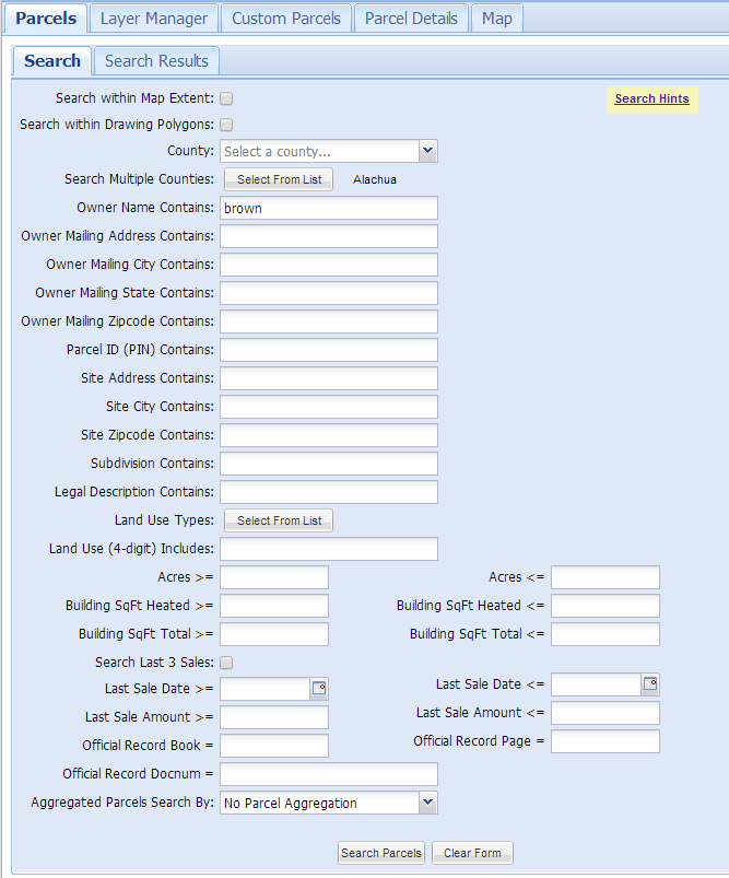
Search within Map Extent
Search within Drawing Polygons
County
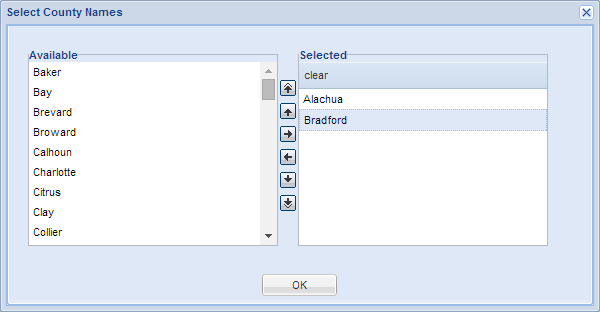
Search Multiple Counties
Owner Name Contains
Owner Mailing Address Contains
Owner Mailing City Contains
Owner Mailing State Contains
Owner Mailing Zip Code Contains
Parcel ID (PIN) Contains
Site Address Contains
If you are just searching for an address to zoom to, it is better to use the address search bar above the the map. The address search bar is much more forgiving on the format of the address, whereas using the parcel search form requires much greater accuracy in specifying the address. Searching for addresses in the Parcel Search Form is better for finding a list of parcels along a street.
Site City Contains
Site Zip Code Contains
Subdivision Contains
Legal Description Contains
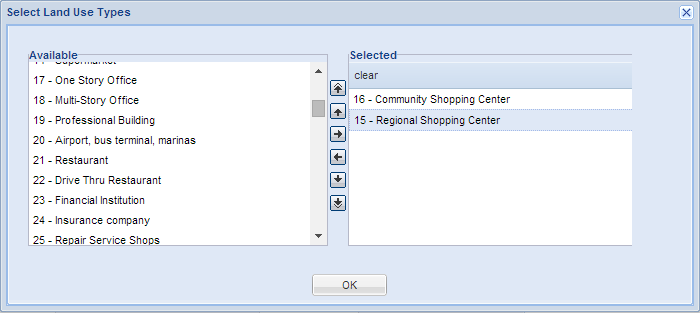
Land Use Types
Property Appraisers assign Land Use type codes to each parcel. The code represents the dominant land use for that parcel. The Florida Department of Revenue (FDOR) defines the main land use categories for the state. Individual county Property Appraisers also define more detailed codes that vary between counties. This search option provides a uniform land use classification to search across the state.
Land Use (4-digit) Includes
Individual county Property Appraisers usually define more detailed four-digit land use codes. The first two digits are standardized statewide, but the second two digits are unique to each county.
Acres
Building SqFt Heated
Building SqFt Total
Building SqFt Adjusted
Year Built Actual
Year Built Effective
Search Last 3 Sales
This option provides searching the previous 3 sales of a parcel for a match. For example, if you want to find properties sold between 5/1/2017 and 7/1/2017 and its currently 2019, there could be more than one sale since 7/1/2017. You would miss these sales unless you searched the same parcel for more sales transactions.
Last Sale Date
Search sale date by minimum date, maximum date or a range of dates.
Last Sale Amount
Official Record Book and Page
Search by Book and Page numbers assigned by the County Recorder. Some counties have switched to using only Document Number.
Official Record Docnum
Search by Document Number assigned by the County Recorder.
Aggregate Parcels Search By
The purpose for aggregated parcel data is to quickly search large tracts of land consisting of multiple parcels. The aggregated parcel data contains parcels over 9 acres. Parcels aggregated by county and available statewide. A great way to visualize how aggregation works is to explorer the layers in the Map tab. The default search option is No Parcel Aggregation.
Parcels are aggregated in three different ways.
Sale Transaction
Aggregated by book / page or docnum. Do not use this to search for individual sales of small parcels.
Owner Name
Aggregated by owner name county-wide.
Owner Name - Disaggregate
Aggregated by owner name, where contiguous parcels are aggregated by owner. Other parcels with the same owner within the county are separate entities (polygons).